Geotechnical and environmental site investigation in Athlone forms the essential first phase of any construction or civil engineering project, providing critical data on the ground conditions that will directly influence foundation design, earthworks, and long-term structural performance. This category encompasses a comprehensive suite of intrusive and non-intrusive techniques designed to characterise the subsurface profile, assess soil and rock engineering properties, identify groundwater regimes, and detect potential contamination. In a town experiencing steady residential, commercial, and infrastructural growth along the River Shannon, a robust understanding of the underlying geology is not merely a regulatory requirement but a fundamental risk management tool that prevents costly over-design or, conversely, catastrophic under-design.
The local geology of Athlone presents a specific set of challenges and considerations that make a tailored investigation strategy indispensable. The town is primarily underlain by Carboniferous limestone bedrock, which can be associated with karst features such as dissolution cavities, swallow holes, and uneven rockhead profiles. Overlying this bedrock, much of the urban centre and its fringes are covered by a complex sequence of glacial and post-glacial deposits, including dense, stony till and softer alluvial silts and clays along the Shannon floodplain. These alluvial soils can be highly compressible and subject to seasonal volume changes, while the groundwater table is often high and directly linked to river levels. Ignoring these localised conditions can lead to differential settlement, bearing capacity failure, or unexpected groundwater ingress during excavation.
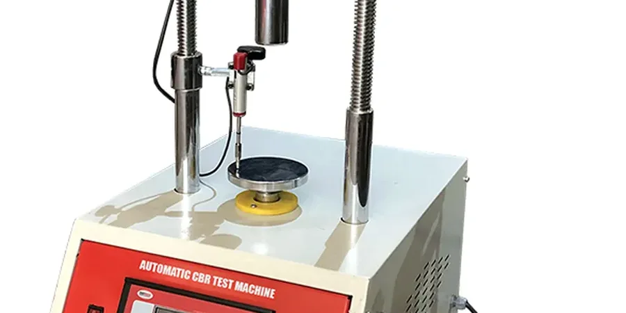
All investigation work in Athlone must be conducted in strict accordance with Irish and European standards, ensuring data quality, reliability, and legal defensibility. The primary framework is provided by Eurocode 7 (Geotechnical design), particularly I.S. EN 1997-2, which governs the planning and interpretation of ground investigations. Complementary standards include I.S. EN ISO 22475 for sampling and groundwater measurements, and the technical guidance documents published by the Institution of Engineers of Ireland and the National Annexes which provide regionally specific parameters. For environmental assessments, the EPA's 'Guidance on the Management of Contaminated Land and Groundwater at EPA Licensed Sites' is the key reference. Compliance with these norms ensures that the resulting Ground Investigation Report (GIR) meets the requirements of local authority planning departments and certifiers.
The requirement for a detailed site investigation in Athlone is triggered by a wide spectrum of projects, from small-scale domestic extensions to large infrastructural schemes. Residential developers rely on these services for estate roads and housing foundations, often requiring in-situ testing like the Cone Penetration Test (CPT) to rapidly profile soft alluvial soils. Commercial and industrial builds, particularly on the town's outskirts on greenfield or reclaimed sites, demand thorough contamination assessments and bearing capacity determinations. Critical infrastructure projects, including flood defence works along the Shannon, bridge upgrades, and wastewater treatment plants, require highly specialised investigations to assess riverbank stability and hydraulic conductivity. Even for agricultural structures or the renovation of historic buildings, a targeted investigation can prevent structural distress linked to ground movement.
Available services
Frequently asked questions
What is the typical scope of a ground investigation for a new housing development in Athlone?
A typical scope is dictated by Eurocode 7 and local planning requirements. It usually includes a desk study, followed by intrusive works such as trial pits, dynamic probing, and rotary-cored boreholes to assess the glacial till and limestone bedrock. In areas with softer Shannon alluvium, in-situ Cone Penetration Tests are crucial for profiling. The investigation must also establish groundwater levels and provide soil samples for laboratory classification and strength testing to inform foundation design and road specifications.
How do Athlone's floodplain conditions affect the design of a site investigation?
The River Shannon floodplain is underlain by highly variable, compressible alluvial silts and clays with a high water table. An investigation here must focus on quantifying settlement potential and lateral variability. This often requires a denser grid of test points and continuous profiling methods like the Cone Penetration Test to detect thin, weak layers. Groundwater monitoring over a tidal cycle is also essential, as river levels directly influence pore water pressures and the feasibility of deep excavations.
What regulations must a site investigation comply with when submitting a planning application in Ireland?
The investigation must comply with the Irish Building Regulations (Technical Guidance Document A) and the principles of I.S. EN 1997-2 (Eurocode 7 Part 2). The resulting Ground Investigation Report must be signed by a chartered geotechnical engineer. All fieldwork should follow I.S. EN ISO 22475 standards for drilling and sampling. If contamination is suspected, the assessment must follow the EPA's guidance on contaminated land. The local authority will reject an application if the investigation is deemed insufficient to characterise the site.
When is a Cone Penetration Test preferred over traditional boreholes for an investigation?
A Cone Penetration Test is preferred when dealing with soft, fine-grained soils like the alluvial deposits found along the Shannon in Athlone. It provides a near-continuous profile of soil resistance and pore pressure, allowing for precise identification of thin strata that could be missed by standard borehole sampling. It is significantly faster and less disruptive for profiling large areas, making it ideal for preliminary route surveys for pipelines or for quantifying the lateral extent of soft ground beneath proposed embankments.